The coronavirus pandemic has dramatically altered our lives. After spending the last two months of our lives confined to our apartments, lockdown 4.0 finally brought with it a sigh of relief (at least for people not living in containment zones). And when we thought things couldn’t get worse than this, we hear news of a mega-cyclone brewing in the Bay of Bengal. The super cyclone is called Amphan and it’s expected to wreak havoc when it hits East India, later today. The cyclone is moving at a speed of over 140 kmph and over a million people are being evacuated from West Bengal and Odisha.
Twelve coastal districts of Odisha have been put on high alert: Kendrapara, Bhadrak, Ganjam, Jajpur, Cuttack, Khurda, Gajapti, Puri, Jagatsinghpur, Balasore, Mayurbhanj and Nayagarh. Heavy rainfall and high-cyclonic winds are to be expected in the area.
Extremely Severe Cyclonic Storm ‘AMPHAN’ with Eye Pattern: 18th May 2020 (0730 to 0750 IST) pic.twitter.com/GAhQO3tGTz
— India Met. Dept. (@Indiametdept) May 18, 2020
The National Disaster Response Force personnel were deployed in the area on Sunday with orders to make massive evacuations. At least 37 NDRF teams comprising of 45 personnel each were deployed in Odisha & West Bengal.
“Amphan very likely to intensify into a super cyclonic storm in next 6hrs. We’ve issued heavy rainfall warnings for Gajapati, Puri, Ganjam, Jagatsinghpur, Kendrapara. Tomorrow rainfall activity to increase in Balasore, Bhadrak, Jajapur, Mayurbhanj, Khurja, Cuttack,” said Mrutyunjay Mohapatra, director of Indian Meteorological Department Bhubaneshwar.
According to a tweet update by PTI, PM Narendra Modi will chair a high-level meeting with MHA, NDMA today.
Delhi: Prime Minister Narendra Modi holds meeting with Ministry of Home Affairs (MHA) & National Disaster Management Authority (NDMA) officials to review the situation arising out of #CycloneAmphan in different parts of the country. Home Minister Amit Shah also present. pic.twitter.com/cxR5rXbsGf
— ANI (@ANI) May 18, 2020
Many parts of Kerela witnessed extreme rains last night due to the impending storm. The government has advised all sea-activities to remain shut till May 21.
Here’s Cyclone Amphan In A Series Of Tweets
Vaikom Mahadeva Temple
Yesterday's #AmphanCyclone effect 😢 pic.twitter.com/fvnhwhjvst— Piyu (Atmanirbharwali) 👩⚕️ 🇮🇳 (@Piyu_Nair) May 18, 2020
The last time Odisha witnessed a super cyclone was in 1999
#Breaking. After 21 years Bay of Bengal hosts a #SuperCyclone as IMD confirms #CycloneAmphan has intensified into a Super cyclone, the highest in the IMD classification for cyclones. 1999 saw #Odisha super cyclone, now this one heading towards the same region. pic.twitter.com/b0ddW7kxuN
— ChennaiRains (Social Distance Now) (@ChennaiRains) May 18, 2020
A video showing the eye of the super cyclone
Hey Folks This Is A 24 hours Satellite Animation of Super Cyclone #amphan. This show us formation of its eye and how it intensified into #Supercyclone, #CycloneAmphan #CycloneAlert pic.twitter.com/sp8dr2OEBg
— IndiaMetSky (@IndiaMet) May 18, 2020
‘Amphan’ intensifies into super cyclone, wind speed above 200 km per hour
Heavy to extremely heavy rainfall, accompanied by high-speed winds and tidal waves are expected in the region.#Amphan #SuperCyclone #CycloneAmphan https://t.co/SOuNr7DVtd
— India.com (@indiacom) May 18, 2020
#AmphanCyclone has intensified into a Very Severe Cyclonic Storm with 3-min winds of 120 kph by IMD, and it is likely to intensify further into an Extremely Severe Cyclonic Storm within the next 24 hours.
Meanwhile, the SW Monsoon officially arrives in the Bay of Bengal.
[1/2] pic.twitter.com/0Y15xVKZYB
— Matthew S. Cuyugan (@MSCuyugan_WX) May 17, 2020
#AmphanCyclone begins an eyewall replacement cycle (EWRC) as the outer eyewall now taking place to be the new inner one.
EWRC usually happens in intense tropical cyclone, and usually, the intensity will weaken due to the erosion of the inner eyewall.https://t.co/42f5rWVSo0 pic.twitter.com/HPE8AwgPIA
— Matthew S. Cuyugan (@MSCuyugan_WX) May 18, 2020
There is now a well-defined eye (though cloudy) according to the latest SSMIS pass.
Despite of slightly increasing wind shear, radial outflow and poleward outflow remains impressive with high OHC & very warm SSTs.
Rapid intensification is expected for the next 48 hours.
[2/2]
— Matthew S. Cuyugan (@MSCuyugan_WX) May 17, 2020
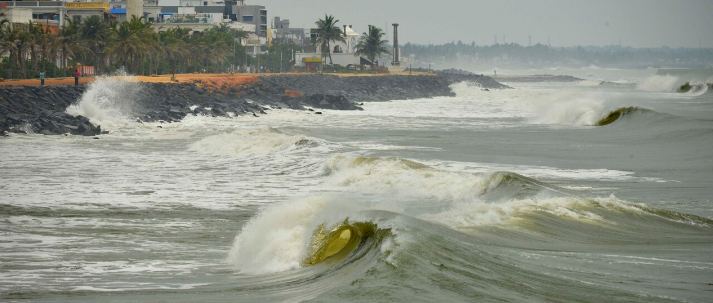
Here are a few pre-cyclone images from different areas
The sea turned rough in #Puducherry on Monday as #AmphanCyclone intensified. Photo: S.S. Kumar / The Hindu pic.twitter.com/yMsGxElck1
— The Hindu – Chennai (@THChennai) May 18, 2020
Heavy rainfall lashes Mangalore
Pic credit: ANI pic.twitter.com/RlrQCudBzC
— The Times Of India (@timesofindia) May 18, 2020
Pre Cyclone Effect in Tamil Nadu @NDRFHQ teams on Standby #AmphanCyclone pic.twitter.com/sAQYtkUYO1
— Siddhant Anand (@JournoSiddhant) May 17, 2020
This accurately explains why afforestation seriously
#AmphanCyclone developing over the Bay of Bengal. Heating of barren land masses increases the chances of cyclones. Afforestation initiatives can reduce both the frequency and impact of extreme weather events. Time to take this seriously.#green_saviours #trees4theplanet pic.twitter.com/zWpDxu9NrY
— The Green Saviours (@green_saviours) May 16, 2020
Glimpse of the cyclone from Pune
A glimpse of Cyclone 'Amphan' today in Pune 1500Km away from its center in Bay of Bengal 😱🌪️⛈️🌬️ Experience it with sound on 🔊#AmphanCyclone #Cyclone #nature #Cloud #cyclone pic.twitter.com/ZwV8Y3t3o2
— Viram Singh (@ViramSingh192) May 16, 2020
First forest fires, riots in Delhi, coronavirus, global recession and now a super cyclone?
Dear Universe, can we skip to 2021 now, please?
Featured Image: Twitter


